 Android - Programs Android - Programs
Path Lane Track
|
Author Victorix
Developed in 2011
Language English Portuguese |
What for
Keep your path, with the aid of the GPS, in a file compatible with Google Earth.
Later the track can be seen.
How it works
Keeps in a data base the aquired GPS values.
GPS coordinates can be written in a file with .kml extension
allowing
direct access to Google Earth.
The GPS is configured to be sampled every 10 seconds and assumes a new bearing as long as it's
10 meters appart from the previous one.
How to configure
 |
Download PathLane to your device
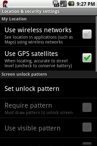
The GPS must be activated by the user as shown.
Select on your device the PathLane icon
 |
 |
Click New Path to prepare the database. This should be done to start a new path. This action will delete previous data in the database
Click on Activate to switch on. |
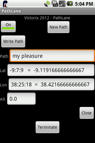 |
PathLane is working. Each new coordinate is shown on the respective places.
Remember that the GPS needs to obtain data form at lest four sattelites. Besides tht, the first coordinate may take longer than the following ones due to GPS initilization. An initial time of three minutes is acceptable. |
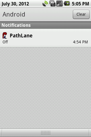 |
PathLane has a service which is active although the mobile is off. To access the PathLane interface please click the icon in the notifiction area. The figure shows PathLane switched off.
Clicking the notification activates PathLane. |
 |
The figure shows PathLane active and saving the GPS coordinates. Click on the notification to access PathLane's interface.
|
What is needed
PathLane only needs acces to the GPS and permition to write on the sdcard.
PathLane does not send data out of your device or communicates with any other aplication.
The Files
The sdcard holds your files on the /pathlane directory.
All files will have an automatic .kml extension.
After copying the files to computer and clicking on them you can visualize your track on Google Earth.
You may delete the files from the PathLane.
Resume
Install PathLane
Activate o GPS
Click the PathLane icon.
Click Button - New Path
Click Button - Activate
Write the Path name - It will be the file name
You may close PathLane by clicking Button - Close
Walk or ride a vehicle..
Go back to PathLane by clicking on the icon or opening the notifications and click on PathLane
To write your path to file click Button - Write Path
Previous steps may be repeated.
To maintain the GPS coordinates beeing saved in the database the Button - Activate must be Active.
Clicking the Button - Terminate ends all PathLane activity.
To restart please click on the PathLane icon again.
Attention: When PathLane is aquiring GPS coordinates and the GPS switched off by the user, a message will be shown and no more data is kept. To reestablish the PathLane functionality it is necessary for the user to activate the GPS again and the click on the PathLane's Button - Activate.
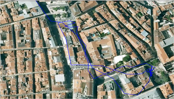
An example
Trip by car and walking in Lisbon, Portugal, seen with Google Earth
Sugestions
My address is Victorix(a)tektonia.com.pt
Thank you and enjoy!
Click to get it from Android Market
|